
Sewer information is hard to find and very cryptic, yet crucial to the functioning of the city. We want more people to know how the system works, and feel empowered to improve it.
How I Started
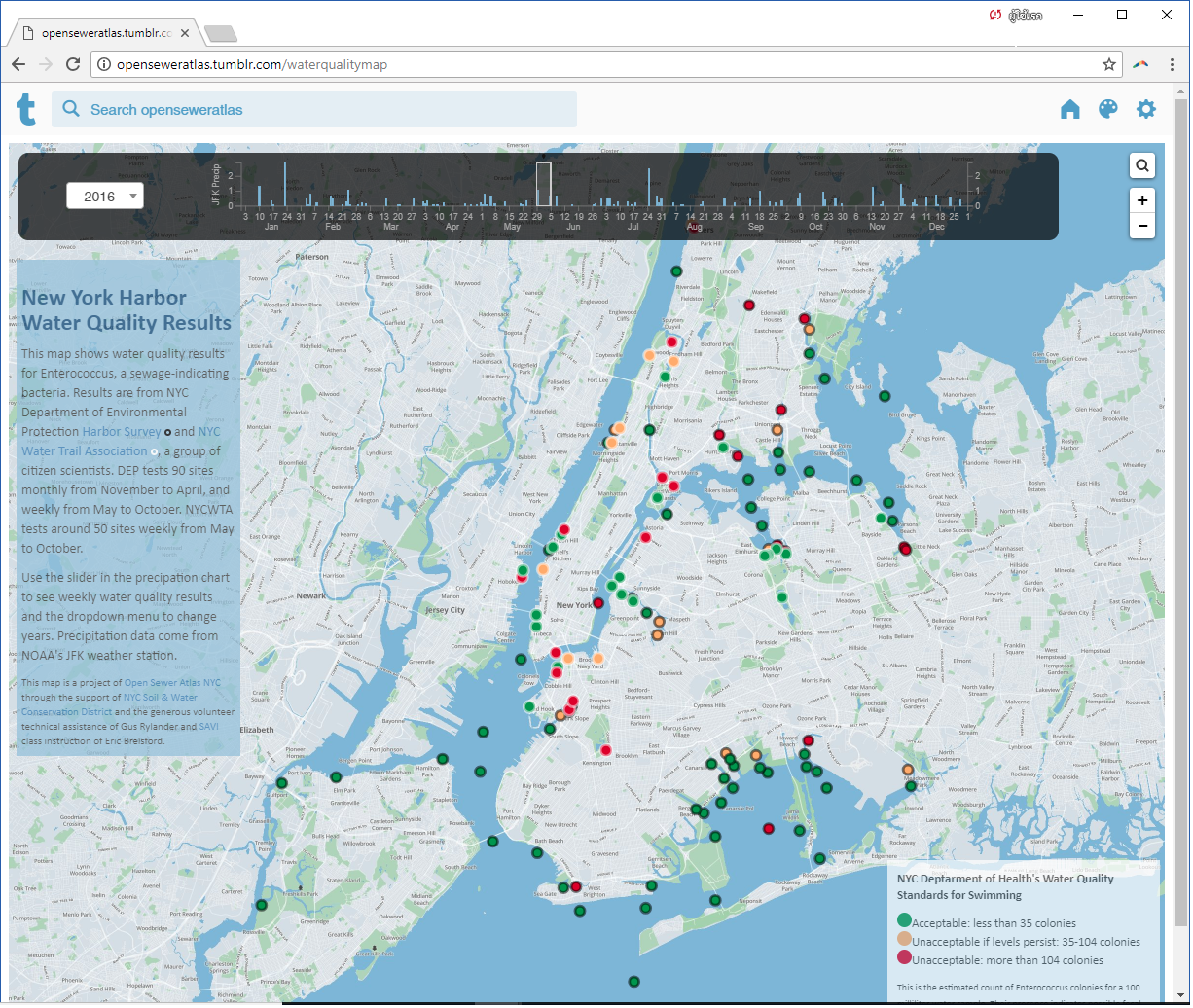
Open Sewer Atlas NYC is a unique community planning project with the goal of creating transparency into the confusing world of NYC’s sewer system. The project uses publicly available maps and data to display a more complete picture of how NYC’s sewer system works.
How I Built This
Open Sewer Atlas is a combination of many maps and data layers, some from Open Data and some scraped from DEP publications. The project started in 2013 with 311 service requests from Open Data to find hot spots for sewer-related complaints, and was funded by the Pratt Center’s Taconic Fellowship. As more data has been published by DEP in pdfs, and as Open Data has evolved, the project has developed and evolved to suit the interests of different water advocacy groups. The project currently consists of a series of nearly a dozen static maps, several interactive maps, and downloadable shapefiles and datasets of the all the data I have been scraping and collecting from different DEP publications. The project has been funded by grants and other organizations, and is administered by the NYC Soil & Water Conservation District. While I manage it on my own, I continually receive input from stakeholders and partners, which help inform the evolution of the project.